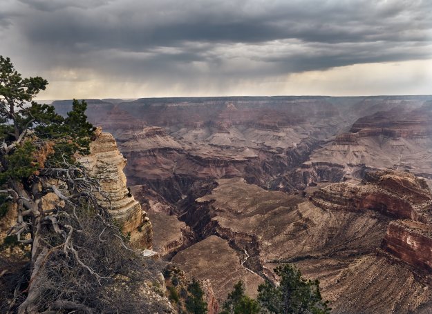
Late summer rain over the Grand Canyon as seen from the South Rim
I’ll be honest… When I first stepped up to the scenic overlook at the South Rim my first thought wasn’t of the beauty of the vista, rather it was (Homer Simpson voice) “Holy Cr@p! I’m going to hike to the bottom of that in the morning?!”
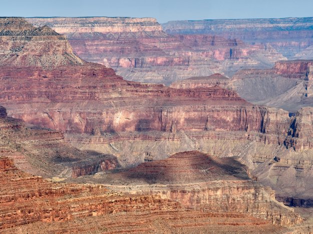
Millions of years visible in the many layers of the canyon walls.
I’ve wanted to backpack in the Grand Canyon ever since reading Colin Fletcher’s “The Man Who Walked through Time” back in the late ’70’s. Somehow I never managed to get around to it, and since I don’t care for crowds the thought of going to the busiest National Park in the system wasn’t entirely a pleasant one. Then earlier this year I saw that Recreational Equipment Inc. ran backpacking trips from both the north and south rim, so I decided finally to go for it.
REI rates the trip as strenuous – a “5”- their highest level of difficulty, so I figured we wouldn’t be doing the tourist trails. As a result they require a doctor’s clearance and send multiple warnings about how difficult and precarious the trails are. They stopped just short of having a chorus chanting “Abandon all hope, ye who enter here!” at the trailhead. Barely. In all seriousness, it is strenuous hike with a lot of elevation change. They have had issues with people not being in sufficient shape or being terrified of heights needing to be escorted out early. This pulls one of the guides away from the group with all the complications that entails. Still, I thought the warnings were a bit over the top.
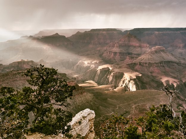
The sun peeks out during an afternoon shower.
I arrived at Grand Canyon Village the afternoon before the trip. Since I was driving up from Phoenix it made sense to get there a little early and see the sights up on the rim. I elected to stay at the Yavapai Lodge in the Park boundary since it was close to our meeting point. It turns out that the concession lodging is considerably cheaper than the nearby hotels, so if you decide to visit try them first. There’s also camping at the Mather campsite, but I decided on having the luxury of a bed the last night. It being the week after Labor Day the crowds were minimal.
The actual trail and route selected depend on the season and the permits issued by the Park Service, so you don’t know the actual route until getting the final trip bulletin about a week before you leave. Since ours was the first post summer trip we took the Hermit Trail which has reliable water along the route. Even so this is desert terrain, and you need to be able to carry a gallon of water.
We met a 8:00am Thursday morning for a greeting from our guides Tom and Marci, to divide up loads, and for a pack check prior to leaving for the trailhead. The goal is to leave the trailhead with a 35 pound pack. Plan on carrying 10 pounds of tent and group gear, so when you subtract water you’re looking at 17 pounds as your planning weight. Considering that you are responsible for your own snacks and lunch this means ruthless cutting of weight. My food selection was two flat bread sandwiches per day (peanut butter and jelly, with one day of tuna thrown in for variety) and two ounces each of almonds, peanut butter pretzels, and jerky with a granola bar for snacks each day. This came to one pound of food per day. At the last minute I left one set of sandwich makings at the car and followed the guides suggestion of bringing leftover pizza for the first lunch. Mmmmm, pizza. As it turns out I could have cut back on one of the snacks each day. I also brought along 12 Gatorade packets and instant coffee for each morning. My share of the group food weighed in at 7 pounds.
Since you leave a car at the trailhead I brought extra gear to use depending on the conditions. I was prepared to go without a tent using a sleeping bag and ground cloth or with a tent using a poncho liner. It being the end of the monsoon season in the southwest, with possible thunderstorms during the week I elected to go the tent route. I ended up overweight at 40 pounds full load since I brought an Olympus Pen F camera with two lenses and extra batteries, as well as my “10 essentials” kit that I don’t hike anywhere without. I wasn’t concerned about it as I had trained with an overweight pack and knew the load would be lighter in four days when we hiked out.
After we all got our gear sorted out we caravanned over to the Hermit Trailhead with a stop at the Pima Point overlook so we could see the days hike from the top. From there we went to the trailhead and started out around 9:30.
Taking a break on the Hermit Trail.
The Hermit Trail was built in the early 1900’s to access a camp site for well-to-do tourists who would ride down on mule back. It looked to be quite a luxury camping experience, but as with many wilderness camps it went out of business around the great depression. All that remains now are the ruins of a tram used to get supplies to the camp and the occasional stretch of cobblestone trail.
While the trail is only 5.9 miles long, being almost completely downhill it took quite a bit longer to cover than I expected. We stopped to top off water and take a rest break at Santa Maria Springs about two miles down the trail then continued on to the Tonto Trail where we hiked another 1.2 miles to the Hermit Creek campsite. We arrived at camp around 5:15pm so it was nearly an 8 hour hike to the first camp. The first thing we did after dropping our packs was to wade into Hermit Creek to cool off our feet while filtering water. To my surprise I drank almost all of the four quarts I packed on the way down.
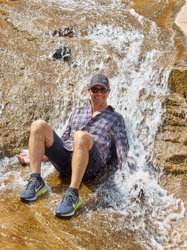
Tom demonstrates the preferred way of cooling off.
After setting up camp we took time to relax in the creek and nearby waterfall. Unlike most desert camping once we got down to the lower elevations we were able to spend a lot of time in the water both cooling off and staying cleaner than on most backpacking trips. Tom and Marci took care of preparing dinner and the little details of making camp, somewhat to our discomfort as it seemed like we should be helping out, but they both had strong opinions of what the guide job consists of. Once dinner was done all food was secured in a “Rat Sack” and stashed out of reach of squirrels, birds and rodents.
Around 7:00pm a couple we had passed on the trail came in, the gentleman is some distress being unable to hold down any food or water since lunch. They were hoping that he would recover over night at camp, but he had a bad night and by morning none of us felt he would be able to hike out of the canyon unassisted. Our guides had a inReach satellite text setup that would allow contact with the outside and a call for help if necessary, and offered to call the Park Rangers to set up evacuation. We had found some electrolytes he could keep down, so they decided to rest during the day before making the call. Our schedule was to hike up to the Hermit Creek source and be back in the afternoon, so we arranged to check on him then.

Me with boulder. It must have made a spectacular sound when it fell from the canyon wall.
Our hike up the creek was fun since we were carrying only water and snacks, with lots of wading, waterfalls and a little bouldering. We also went over to investigate the ruins of the trolley base, finding a surprising amount of broken china shards and 19th century vintage gear used at the old Hermit camp. Even an old partially buried storage shed, perhaps an ice house was in good condition.
Returning to camp in mid afternoon our friend had decided that calling for help was in order, so Tom connected with the Park Service and provide location and medical data. Since the back and forth via text took an hour or so (the messages do not necessarily send immediately) we figured it would be a while, but as soon as they had enough information a helicopter with Paramedics was dispatched. We were all relieved. The gentleman’s fiancee would have had to hike out the next day to get help had our guides not been prepared. As it was they were able to fly her and their gear out together.
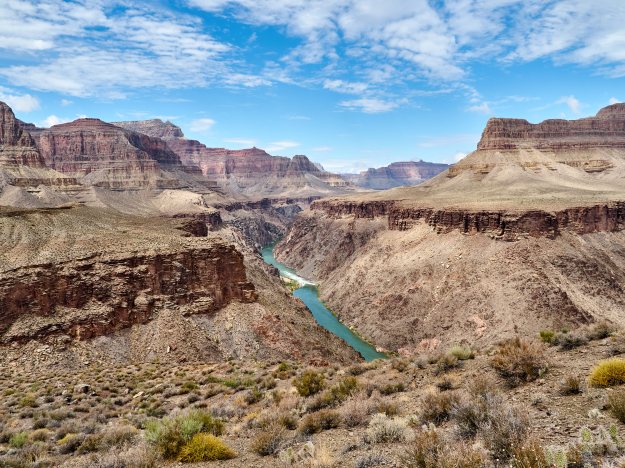
We loaded up and continued our trip down the creek till it joined the Colorado River at Hermit Rapids. This was a short hike of only a couple hours, so waiting till later in the afternoon made sense as there isn’t any shade at the night’s camp site. We took our celebratory plunge into the river upstream of the rapids and proceeded to the beach area to set up camp. Overall it was an easy rest up day with a lot of pleasant day hiking. After dinner we settled in and listened to the sound of the rapids and enjoyed the view.
Hermit Rapids as seen from the Tonto Trail. We camped on the little beach to the left of the rapids.
The following morning after our breakfast burritos and coffee/tea/hot chocolate we loaded up and headed back up to the intersection of the Tonto Trail to traverse over to Monument Creek for our third camp site. The Tonto Trail runs parallel to the Colorado River and at 93 miles is one of the longest in the Park. While relatively even in elevation, being a traverse it feels more exposed the the Hermit Trail. The five mile hike passed quickly and we arrived at the camp around 2:00 pm.
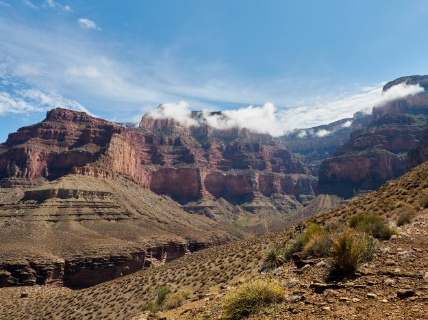
Approaching the Monument Creek camp site as seen from the Tonto Trail.
After cooling off in Monument Creek, we proceeded on another day hike down the series of waterfalls leading to the river. This portion of the trip was the most challenging as far as bouldering went, in part because of the terrain and in part out of trying to negotiate the stream without touching water. This is a game among the guides who will try not touching water on the way down, and not touching dry land on the way back up to camp. I did manage to knock my camera into the rock walls on a couple of occasions as well as taking a couple of minor falls to gather up some scrapes and bruises, but nothing serious.
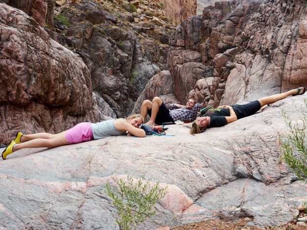
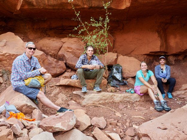
Ashley, Tom and Marci relax at Monument Creek.
Making it back to camp we had our dinner and a nice little astronomy session. It was the first cloudless night, and while being in a mile deep canyon limits the amount of sky you can see it was still a beautiful dark sky. This last night in the canyon I skipped the tent and slept in the open.
Come morning we rose early and had our granola breakfast and coffee prior to starting the climb out a 6:30. All of my training paid off as my pack which had not bothered me at all on the trip now felt positively light, even with a full load of water. It being a clear sky the early start let us take advantage of the morning shade for most of the trail, and we made good time. Personally I use a rather plodding pace when hiking up hill, but take few breaks preferring to rest by altering my pace. Others used a brisker pace with more frequent stops. Both methods worked as we kept in visual contact the entire time. Stopping for lunch at the little shaded hut at Santa Maria Springs we topped off on our water and proceeded the last two miles getting back to the trailhead around 1:30. Yes, it took longer to hike down than back up! After enjoying some chilled watermelon and sodas Tom and Marci had in a cooler in the car we said our goodbyes and headed our separate ways after a great trip.
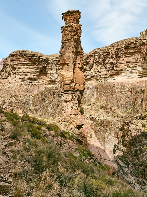
The Monument.
Some thoughts on training and lessons learned…
The most important training you can do for a trip like this is to do a lot of hiking with a full pack and in the shoes you plan to wear. Living near Phoenix I have lots of desert terrain and hills to hike although nothing with a 5000 foot elevation change. I started training five months beforehand with a 45lb pack and never had a problem on the trip. It helps to have a pack that fits you. If you’re 5’8 to 6’1 most off the shelf packs will work, but for the best fit (or if you are smaller or larger than average) a sized pack like those produced by Gregory Mountain Products or Osprey are well worth the money. My goal was to do two hikes a week, one long and one short which worked well until it got too hot during the summer when I switched to two short hikes. I ended up hiking about 190 miles in training. In addition to hiking I ran 2 miles three times a week for cardio, but to be honest I’m not sure that really helped, although it certainly didn’t hurt.
Water shoes are an absolute necessity on this trip, and if they have sturdy soles and decent support may be what you want to use for hiking. Our guides went this route and used flip flops for camp shoes. I went with light hikers for the trail and Chaco sandal type water shoes which worked well for traction. One lesson – if you use open type water shoes wear water socks with them. The Chacos were great in the water or when dry, but when hiking on sand while they were wet they tended to pick up grit and were pretty abrasive. I had a couple places on my feet that were rubbed raw, but they weren’t in areas that gave me a problem with my hiking shoes so it was of minimal discomfort. Next time I’ll bring water socks.
It being the desert water is a big deal, and the 3 liter Camelbak bladder in my pack along with a quart Nalgene bottle worked well. Most of us kept an electrolyte mix in the quart bottle. We used a filter for creek and spring water. I also carry water purification tablets as a back up since filters do fail. Boiling water works in a pinch but isn’t practical mid hike.
I found trekking poles to be useful when backpacking in the streams and for the climb out, but not absolutely necessary. I don’t generally use them, but got a set of light weight trail running poles and tried them out on my practice hikes. Once I figured out where they helped and where they didn’t I decided to bring them. If you use them, bring them, if not, don’t worry about it.
I’m a little leery of heights, but not terribly so. I thought the most disconcerting view was from the overlook at the rim. The trails are wide enough that I never had an issue with it, but Tom and Marci assured me that some people do. So if you’re petrified of heights this is probably not the trail for you. If you’re uncomfortable with them all you need to do is watch the trail, not the view. If you want to take pictures or take in the view – stop – once you’re done and put your camera or binoculars away then start hiking again. Also, if you spend a little time practicing walking on a 20-30 degree slope up, down and sideways it will really help. Most people don’t realize how little that kind of slope bothers you if you just stand up straight and bend at the ankles.
Because it was late monsoon season I elects to bring a tent. While it did rain a little the first two nights I would have been fine just wrapping up in a tarp. I used an army surplus poncho liner (22 ounces) instead of a sleeping bag and it was more than warm enough for the second week in September. I did have a regular sleeping bag in case but left it at the car. I also never needed my rain jacket, but as with the tent bringing it was the right decision for the season. We could have just as easily had a gully washer.
If you’re not used to desert you might want to pick a cooler season for this trip. Don’t look at the temperatures at Grand Canyon Village as down on the river is quite a bit warmer. We had light cloud cover most of the time which is the best condition for desert hiking. When the sky is clear the sun makes it much hotter than the temperature would indicate. Drink water!
Finally, using an outfitter like REI is not absolutely necessary, but sure makes the process easier as they take care of the permits and logistics. While this is not a trip for a first time hiker, if you are unfamiliar with desert terrain having experienced guides makes it a lot more comfortable.
The Grand Canyon is not an impossible hike, but you need to be prepared to enjoy it. If you are it’s the trip of a lifetime and I highly recommend it.
